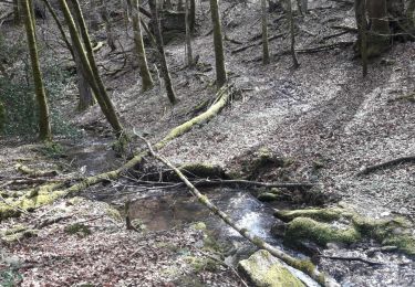
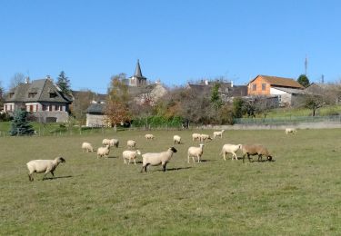
Tocht Stappen Le Nayrac - Le village fleuri de Nayrac - Photo

Le village fleuri de Nayrac

 houbart
houbart

Gebruiker

© OpenStreetMap contributors
Lengte
Lengte
5,2 km
Max. hoogte
Max. hoogte
708 m
Positief hoogteverschil
132 m
Km-Effort
Km-Effort  
7 km
Min. hoogte
Min. hoogte
611 m
Negatief hoogteverschil
132 m
Boucle
Boucle
Ja
Datum van aanmaak :
2024-03-26 09:32:54.238
Laatste wijziging :
2024-03-26 09:33:49.133

(1 Bericht)

Stappen
Stappen
1h35
Moeilijkheid : Medium

Scan deze QR-code om de tocht te openen in de SityTrail-applicatie

Gratisgps-wandelapplicatie

Logo SityTrail SityTrail

IGN / Geografische instituten

SityTrail uit de App Store downloaden SityTrail uit Google Play downloaden

Logo SityTrail SityTrail World

De wereld gaat voor u open

SityTrail uit de App Store downloaden SityTrail uit Google Play downloaden SityTrail op Huawei AppGallery downloaden

Over ons

Tocht Stappen van 5,2 km beschikbaar op Occitanië, Aveyron, Le Nayrac. Deze tocht wordt voorgesteld door houbart.

Hoogteprofiel

POI's

POI Le Nayrac - Place de l'Église - Photo
houbart
POI Le Nayrac - Vers le plan d'eau - Photo
houbart
POI Le Nayrac - Route de desserte de Serry - Photo
houbart
POI Le Nayrac - Le Bancarel - Photo
houbart
LE NAYRAC 
POI Le Nayrac - Jonction avec la D97 - Photo
houbart
POI Le Nayrac - À gauche au cimetière - Photo
houbart
POI Le Nayrac - Retour par la D97 - Photo
houbart
POI Le Nayrac - Place de l'Église - Photo
houbart

Plaatsbepaling

Land:
France
Regio :
Occitanië
Departement/Provincie :
Aveyron
Gemeente :
Le Nayrac
Locatie:
Unknown
Vertrek:(Dec)
Vertrek:(UTM)
473213 ; 4940028 (31T) N.

Opmerkingen

Gelieve in te loggen om een commentaar of een beoordeling achter te laten


Wandeltochten in de omgeving

Tocht Stappen Campuac - campuac - Photo
Stappen
yves12

Stappen

Medium
(1)
Campuac, Occitanië, Aveyron, France
22 km | 32 km-effort
5h 8min
Ja
Tocht Te voet Le Nayrac - Un Village Fleuri - Photo
Te voet
PRO

Te voet

Gemakkelijk
Le Nayrac, Occitanië, Aveyron, France
4,9 km | 6,6 km-effort
1h 29min
Neen
Tocht Trail Coubisou - douluch le ruisseau  - Photo
Trail
jdaviere

Trail

Zeer moeilijk
Coubisou, Occitanië, Aveyron, France
11,8 km | 17,1 km-effort
2h 21min
Ja
Tocht Stappen Florentin-la-Capelle - Florentin La Capelle (Aveyron) - Photo
Stappen
houbart

Stappen

Moeilijk
Florentin-la-Capelle, Occitanië, Aveyron, France
9,8 km | 13,6 km-effort
3h 5min
Ja
Tocht Stappen Golinhac - Randon fonteilles bozouls def - Photo
Stappen
Jacques Manzoni

Stappen

Zeer moeilijk
Golinhac, Occitanië, Aveyron, France
19,4 km | 28 km-effort
6h 21min
Neen
Tocht Stappen Golinhac - 70_07_02_Fonteilles_Conques - Photo
Stappen
jeanlucien

Stappen

Moeilijk
Golinhac, Occitanië, Aveyron, France
27 km | 37 km-effort
6h 20min
Neen
Tocht Elektrische fiets Coubisou - bouzouls par la voie ferrée d'Espalion  - Photo
Elektrische fiets
jdaviere

Elektrische fiets

Gemakkelijk
Coubisou, Occitanië, Aveyron, France
47 km | 62 km-effort
2h 59min
Ja
Tocht Mountainbike Coubisou - gohinlac - Photo
Mountainbike
jdaviere

Mountainbike

Gemakkelijk
Coubisou, Occitanië, Aveyron, France
47 km | 65 km-effort
2h 24min
Ja
Tocht Elektrische fiets Coubisou - Estaing par la pisciculture  - Photo
Elektrische fiets
jdaviere

Elektrische fiets

Moeilijk
Coubisou, Occitanië, Aveyron, France
36 km | 50 km-effort
2h 29min
Ja


Sluiten
Mijn abonnementen